Isochrone API
No public endpoint yet
The Isochrone API is enabled per API key. Contact VIETMAP to enable it and receive the endpoint, parameters and integration details:
- Zalo OA: Vietmap Solutions
- Email: maps.info@vietmap.vn
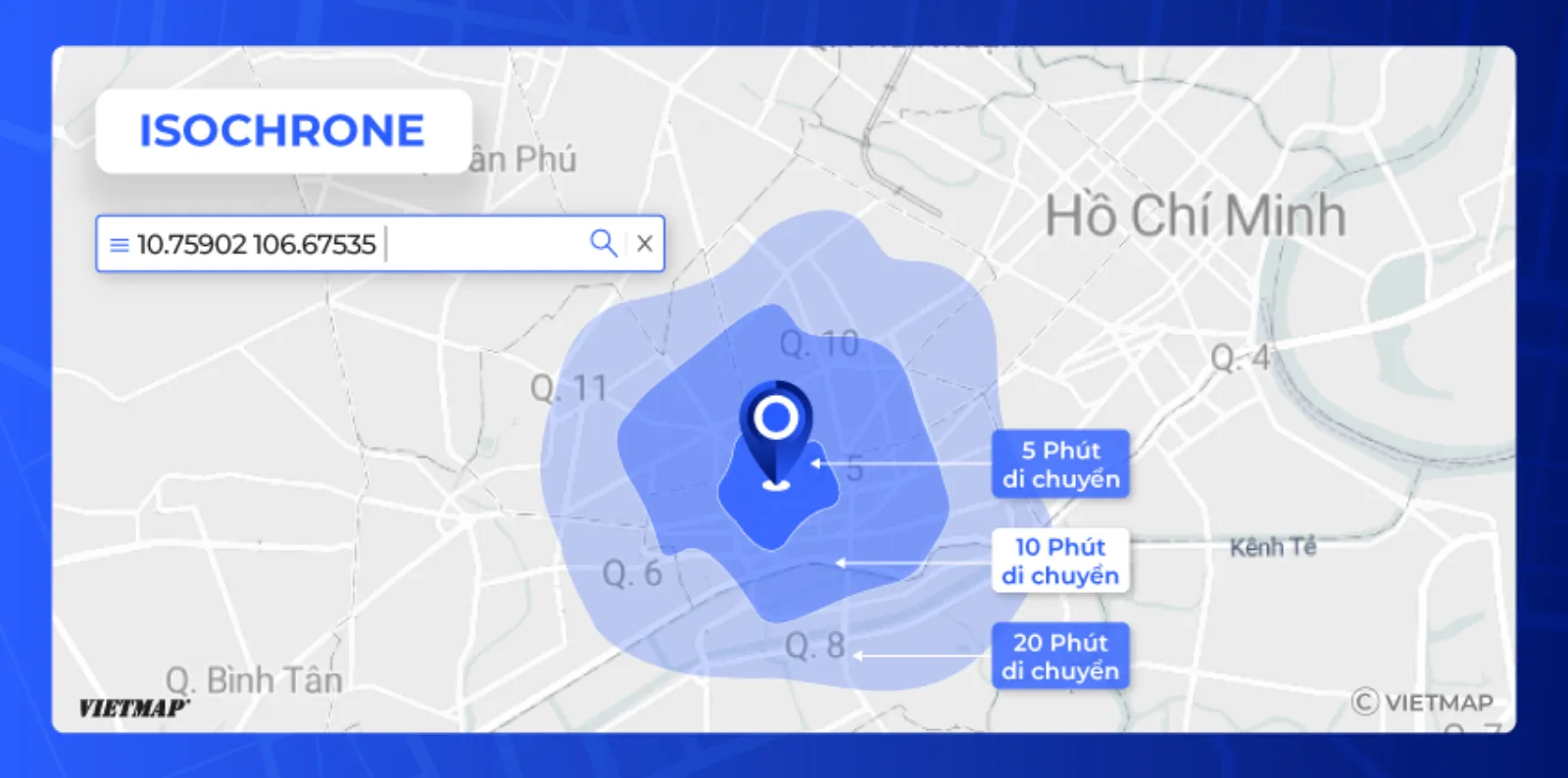
The VIETMAP Isochrone API returns the area reachable from a point within a given travel time or distance, as polygon or line contours.
It is computed on the real VIETMAP road network — the same network behind Routing — so it follows one-way streets, respects road classes and vehicle profiles, and stops where the network stops.
Isochrone vs. a radius circle
| Radius circle | Isochrone | |
|---|---|---|
| Measures | Straight-line distance | Travel time or distance on roads |
| Rivers, canals, dead ends | Ignored | Respected |
| One-way streets, road class | Ignored | Respected |
| Shape | Always a circle | Follows main roads, irregular |
| Answers | "Within 5 km as the crow flies" | "Reachable in 15 minutes by motorbike" |
What you can build with it
| Use case | What the isochrone gives you |
|---|---|
| Store / branch site selection | How many people and competitors sit inside a 10-minute drive of a candidate address. |
| Delivery zones | A realistic serving area per branch instead of a flat radius, so riders are not sent across a river. |
| "Which branch serves me?" | Assign a customer to the outlet that can actually reach them fastest. |
| Real estate analysis | Commute-time catchments for a listing: how much of the city is within 30 minutes. |
| Electric vehicles | Remaining range expressed as reachable area, not kilometres. |
| Fleet & scheduling | Which vehicles can make a pickup window from where they are now. |
| Transport planning | Accessibility of a district before and after a new road opens. |
Pair it with Branch Locator & Management to draw your store network inside the isochrone, or with the Distance Matrix when you need exact times between specific pairs rather than an area.
Frequently asked questions
What is an isochrone?
An isochrone is the area you can reach from a starting point within a fixed travel time — for example everywhere within a 15-minute motorbike ride. Unlike a circle drawn with a radius, it follows the real road network, so it stretches along fast roads and stops at rivers, one-way streets and dead ends.
How is an isochrone different from a radius?
A radius measures straight-line distance and ignores roads entirely. In a city like Ho Chi Minh City a 5 km radius and a 15-minute isochrone look nothing alike: the isochrone reaches much further along main roads and much less across canals or through narrow alleys. For any question about who can actually reach you, the isochrone is the correct shape.
What can I use an isochrone API for?
Common uses are choosing where to open a store, defining realistic delivery zones per branch, showing customers which outlet actually serves them, sizing a catchment population for real estate, and checking how far an electric vehicle can go on its remaining charge.
How do I get access to the VIETMAP Isochrone API?
Isochrone is enabled per API key on request. Contact VIETMAP on Zalo OA or at maps.info@vietmap.vn to have it enabled and to receive the endpoint, parameters and integration details.
Related APIs
- Routing API — the route itself, for car, motorcycle, truck and container.
- Distance Matrix — travel time between many origins and destinations.
- Geofencing — virtual boundaries with enter/exit detection.
- Branch Locator & Management — put your store network on the map.